Cork City is one of the oldest cities in Ireland and has a rich archaeological record. Its unique character derives from the combination of its plan, topography, built fabric and its location on the River Lee at a point where it formed a number of waterways. Even the name Cork is derived from the word marsh (Corcaigh in Irish).
The earliest recorded settlement in Cork was a monastery founded by Saint Fin Barre in the 7th century. From historic sources it is evident that by the 9th century the Vikings were raiding Cork. Recent archaeological excavations during the Cork Main Drainage Scheme and on the South Main Street have contributed greatly to our knowledge of the late Viking period in Cork. This phase in Cork’s development is known as the Hiberno-Norse period. The results of the archaeological excavations have reinforced the idea that by the mid-11th century settlement in the city consisted of a series of raised clay platforms, surrounded by wooden fences or revetments. Houses were subsequently built on these clay platforms. The Hiberno-Norse city was captured by the Anglo-Normans in the late 12th century and the city was subsequently fortified with stone walls.
Maps from the late sixteenth century show the medieval walled city of Cork as an impressive elliptical area characterized by towers, battlements and crenellations. There were fortified gates at the present North and South Gate Bridges and a marine gate and central channel which would have allowed access to ships and boats.
The wall was largely demolished in the 18th century to make way for the rapidly expanding town and as a result there are no above ground standing remains of the walls present today. However as evidenced by many archaeological excavations, the below ground level preservation of the city wall is phenomenal and this stems from Cork’s location in an estuarine marsh. The difficulties of building and maintaining a wall in a tidal estuary would have been immense. The habitation levels would have been constantly raised to protect against the tidal floodwaters.
The line of the medieval city wall was largely derived from the line of the existing river channels. The layout of the medieval city is still evident in the street plan of the historic core of Cork i.e. North and South Main Street. The street would have been narrower, but nonetheless followed an identical course. Many laneways and alleys lead off the main street at right angles. Some of these laneways exist to this day. Others are fossilised in the layout of houses, with doorways to yards and other properties marking the location of old routes. The size of property units is, in general, as it was in medieval times.
With the advent of artillery Cork was no longer impregnable and was particularly vulnerable to attack from the hills to the north and south of the city. The Anglo-Norman walls would have become redundant as defensive structures. Elizabeth Fort, situated outside and to the south of the walled city is a fine example of a 17th century star-shaped fort. The exceptional view of the city which Elizabeth Fort commands explains why it was such a strategic site.
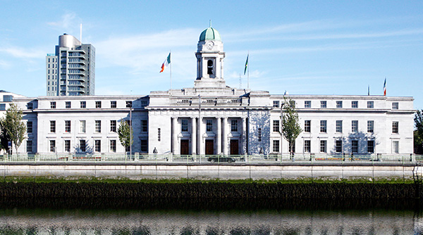
The 18th century was a time of great prosperity and change in Cork City. The city walls were no longer needed, felll into disrepair and were demolished. The river channels which formed a circle around the medieval city were drained in the 18th and 19th centuries and now form a pattern of streets around much of the former walled city. Today the River Lee flows through Cork City in two main channels. A visitor to the city will find themselves crossing many fine bridges as a result. Cork City’s main thoroughfare St. Patrick’s Street was once a river channel which was culverted and filled in during the 18th century.
For more information see: